
ISZ · Independent technical assessment
PV drone thermography
Thermographic recording of larger PV areas from the air, with assigned and professionally assessed findings.
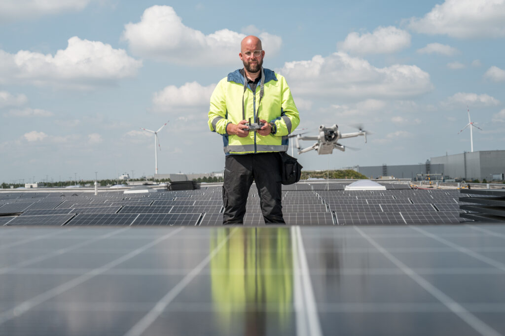
For large rooftop or ground-mounted systems, a drone flight can support systematic recording. We combine the images with a technical evaluation and name the anomalies that should be examined further on the ground.
Reasons for inspection
Examining large system areas clearly
For operators, asset managers and technical project managers, what counts is that anomalies are not only detected but can also be found again in the system and dealt with.
01
Recording areas systematically
Agreed rooftop or ground-mounted areas are recorded according to a coordinated plan. Site conditions and possible restrictions are taken into account in preparation.
02
Assigning anomalies
Thermal findings are assigned as far as image quality and the available system plans allow. This makes subsequent on-site examinations easier.
03
Targeted follow-up
The evaluation helps to select areas for closer visual inspections or electrical measurements. A drone flight and a detailed inspection fulfil different tasks.
Scope of services
Drone flight with a clearly defined aim
The scope depends on area, system design, location and the question. The following can be agreed:
- Review of site and system plans and agreement of the flight area
- Check of organisational and site-related requirements
- Thermographic and visual images of the agreed areas
- Evaluation and assignment of relevant thermal anomalies
- Report with findings, recording conditions and recommended follow-up inspections
Result
From the aerial image to a workable checklist
You receive a technical evaluation of the areas examined. Relevant anomalies are documented with images and, as far as possible, assigned spatially. Limits of the findings, areas not recorded and open questions are named. The results can then be dealt with together with the responsible technical parties.
The drone is a tool for recording. What remains decisive for the assessment are suitable conditions, sufficiently meaningful images and the professional classification of the findings.
Working together
Preparing site, recording and evaluation
01
Planning the flight
Location, size, access and possible restrictions are checked. You provide existing plans and a contact person for the site.
02
Recording the areas
The images are taken under suitable weather and operating conditions. The areas recorded and relevant boundary conditions are documented.
03
Passing on findings
The evaluation classifies anomalies and describes sensible next examinations. This allows the further inspection to be prepared in a targeted way.
Your enquiry
Are you planning a thermographic drone flight?
For the initial consultation, the location, approximate system size and a site plan or aerial photo are sufficient. Please also state any known operational or site-related restrictions.
Frequently asked questions
Questions about drone thermography
Is a drone flight possible at every site?
This is checked in advance. In addition to weather and the situation of the system, the respective site conditions, access and necessary permissions have to be taken into account. Only after this clarification can the flight be planned bindingly.
Is every single module reliably assessed?
Such a blanket promise would not be reliable. The extent of recording and the level of detail depend, among other things, on recording conditions, visibility, system geometry and the method chosen. The report names the scope actually examined and possible limitations.
What happens after a conspicuous image?
The finding is first classified and assigned spatially. Depending on the question, a visual inspection of the module, supplementary electrical measurements or further examinations may follow. A thermal image alone does not prove a definite cause of damage.